Driving by Israeli settlements in colonized Palestine
There’s no possibility of a two-state solution. Israel and Jewish nationalists made sure of that with all the settlements they built. I could see it from the window of our bus.
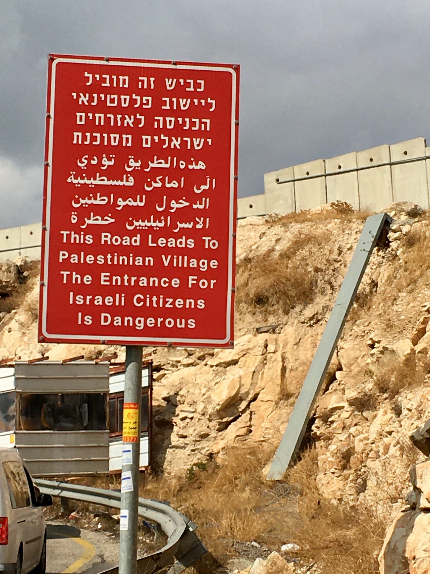
On the road outside East Jerusalem.
In our last episode we talked about Israeli settlements a bit, but I want to expand on the topic — and provide some visuals.
So Last year Evgenia and I travelled by bus and shared taxi from Bethelham all the way to the northern edge of the West Bank, stopping over in Ramallah and Nablus, and then exiting through a border crossing on the outskirts of Jalameh — a spot that seemed to mostly be used by Palestinian laborers who worked on Israeli farms.
The roads we took ran through the center of this butterfly wing-shaped chunk of Palestine. It’s a mountainous area, and for much of the way the highway snaked through valleys surrounded by hills. We passed all sorts of Palestinian villages and cities. I knew that I’d probably see Israeli settlements on the way, but I was surprised by how many of them there were. I kept seeing them lining both sides of the highway as we headed north. Sometimes it felt like they occupied every major hilltop — built like fortresses on defensible positions, lording over the land below.
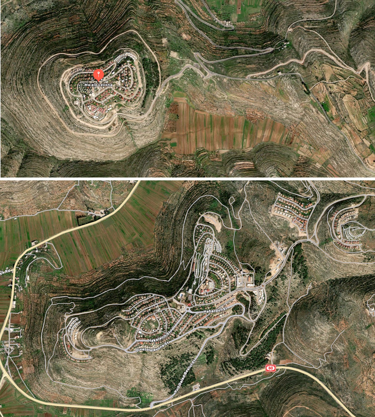
Two master-planned colonization communities in Palestine.
Sometimes — if a settlement was on a hill directly overlooking the highway — I could recognize it by sight from the bus. The security fences and stocky concrete towers were a dead giveaway. The ones that were farther away and out of my line of sight I could spot using the satellite view on Google Maps on my phone. Even without looking at their names, the settlements were very easy to recognize.
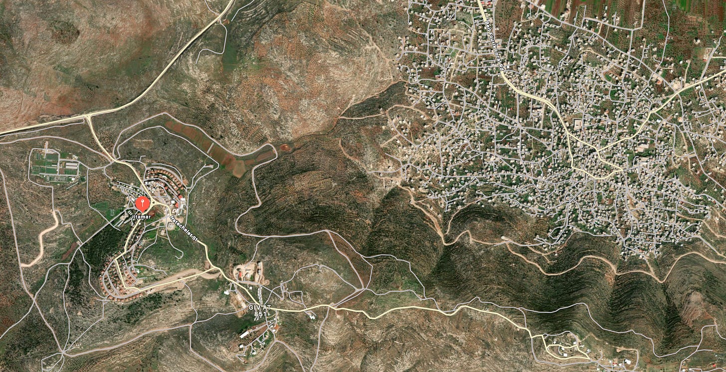
Seen from space, Palestinian villages and towns have an organic, chaotic layout — a sign that they developed and expanded naturally over a long period of time. Israeli settlements had a different type of vibe. They were logically and neatly laid out as one complete package, clearly built in one go. They kinda reminded me of the subprime “master-planned communities” that I got to know well out in Victorville, California: rows and rows of identical houses built according to a generic, mind-numbing suburban layout — the same cul de sacs, curving intersections, houses, and tiny parks and green spaces. There are miles and miles and miles of this kind of development out in California and the Southwest —entire deserts covered with identical houses, streets, neighborhoods, and corporate chains.
Compare the organic form of the Palestinian city of Beit Faruk with Itmar, an Israeli settlement established in the 1980s by religious Jews. Notice that Itmar sits on a hill overlooking Beit Faruk and is situated close to what looks like a military outpost.
But out in Palestine, these master-planned colonization communities weren’t as huge or monolithic. They were smaller, boutique-ier. They were also a lot more militarized — built on defensible hilltops and surrounded by walls, security barriers, check points, fences, towers, gates, armed guards, and connected to Israel with slick, segregated roads designed for Israeli use, and which I could see from time to time out of the window.
As our bus headed north…
…This is a preview of a full letter that is only available to subscribers. To support my work and get the rest, sign up and read it here.
—Yasha Levine


